
Explaining Change
in the Mount Majura Nature Reserve
Project Outline pdf version (67 KB)
Photographic Monitoring – How is it done
View the Change. The 2014 Video (earlier versions: 2013, 2012 , 2011)
Ground-Cover Assessment. The Data
Outlook
Project Information
Project Documents
Media Release 18.03.2013

Project Outline
The aim of this Project is to demonstrate the relative importance of climate and of herbivore grazing on the ground vegetation of the grassy woodlands of Mount Majura.
Our Project began in late October 2009 and involves an Animal Sieve and the monitoring of the ground layer over a number of years.
The Animal Sieve divides an area of grassland into three small 10m x 10m plots (diagram layout of plots). Specially designed fencing keeps kangaroos out of one plot but allows rabbits (and hares) in. It keeps both kangaroos and rabbits out of the second plot. It allows both to graze in the third plot. The native (Eastern Grey) kangaroo and the introduced (European) rabbit are the two principal herbivores that graze the grasslands of the Reserve.
Why this project? Like many visitors to the park, we look for changes in the ground layer vegetation – grasses and broadleaf herbaceous plants (forbs). Over the past years we have witnessed significant decline in grassland abundance and diversity. For example, in the area behind the lower Hackett reservoir, 2005 photographs show an abundance of flowering native grasses (flowering Wallaby Grass Austrodanthonia caespitosa, Mt Majura nature reserve, December 2005) where in 2010 there are only a few.
We ask: why the big reduction of the grassy layer, and is this change permanent? We think of two plausible answers.
The first is seasonal (year-to-year) variation in rainfall. In Canberra most grasses and forbs respond best to winter and spring rain, some forbs and grasses respond best to summer rain while others may flower from spring through to autumn depending on the soil moisture. There are now so few grasses and forbs because, during the last few years, both summer and rainfall has been very low.
The second plausible answer is grazing pressure. While the Reserve is protected from grazing by sheep and cattle, there has been no management of grazing by kangaroos and rabbits. In the last few years, populations of both these grazers have substantially increased. Also, because rainfall has been low, their grazing impact on the ground layer is now greater than before. That is why much of the once grassy Reserve is now a closely cropped lawn, grazed to ground level (closely grazed Redleg Grass Bothriochloa macra, Mount Majura nature reserve, July 2008). The close grazing prevents reproduction of grasses by seed and raises the risk of drought-induced death. The result is loss of diversity, loss of plant cover and active erosion (overgrazed area behind lower Hackett reservoir, Mount Majura nature reserve, June 2009). The only obvious grass species are the less palatable ones, such as the native Speargrasses (Austrostipa species) and the Redleg Grass (Bothriochloa macra) that can persist under grazing because of its spreading growth habit. The most abundant flowering forb is the inedible Mustard Weed (Sisumbrium officinale) and Horehound (Marrubium vulgare).
Which of the two factors – rainfall or grazing pressure – was more important? If we don’t know which, then how can our much-valued Nature Reserve be effectively managed, and thereby conserved? We can’t decide now because we have only opinions but no data: while the rainfall was recorded, there were no measurements of kangaroo and rabbit populations over the last five years. Highly relevant though, are the recent rabbit surveys by ParkCare volunteers that reveal unnoticed and alarmingly high numbers of active warrens (map of 2009/10 rabbit data).
This brings us back to the Animal Sieve Project. FoMM was successful in obtaining funding from the ACT Government to establish this public education project. It cannot explain the changes of the past five years. However, because all three plots will receive the same rainfall but very different grazing regimes, over the next five years this project will answer the question: what is the most important influence on the diversity and abundance of the grassy layer within Mount Majura Nature Reserve – seasonal rainfall variation or grazing by kangaroos and/or rabbits.
FoMM volunteers will photographically record the changes. The changes will also be obvious to the interested walker because you are free to walk around each plot and closely examine them. Information is provided on a nearby signboard.
We intend that the fencing will be temporary: the change will be recorded for 5 years, then the fence will be removed and the subsequent change monitored for a further 3 years.
We hope that you will enjoy it now, and continue to follow the grassland changes as you see them and as they will be photographically captured and displayed here.

Photographic Monitoring – How is it done
Because human memories of a changing scene – the when, what and how much – are inadequate, FoMM volunteers are using repeated photographs to record and so capture any changes. To be of real value, the photography must capture only the scene change, and not be affected by camera type and position, and lighting. Therefore, FoMM volunteers carefully repeat photographs from 22 separate positions (photopoints), at the same time of day (around midday) beginning when the fencing was completed (October, 2009), and now continuing every three months.
Registering the images to each other for each of the 22 photopoints has summarized the changing grassland conditions between and within the three plots. The 22 photopoints are collected into three groups, each emphasizing one particular type of view, and made dynamic by converting them to YouTube videos.
‘Looking along the Fence’ is the first group, comprising five photo-points. Each is an eye-height view along the fence boundaries of plot 1 (total exclusion of herbivore mammals, no grazing) and plot 2 (exclusion of kangaroo, rabbit and hares only). Four of these five views emphasize vegetation contrasts developing between the inside, where grazing animals have been sieved, and the outside, where there is grazing is not restricted. One view records the vegetation contrasts developing between the two fenced plots.
‘Bird’s-eye’, the second, and largest, group of photo-points, imitates the views of a bird perched on the top wire of the (2m high) fence looking down and along it. The set of 14 views also focus on developing vegetation contrasts between the inside and outside of the two fenced plots, as well as between them. From these high viewpoints, the changes in the ground vegetation types and abundance are far more obvious.
‘Panorama’, the last set of three photo-points, provides a 360° survey from the centres of all three plots. The survey is presented as vista each of the four cardinal directions: North, East, South, and West. A wide-angle fisheye lens is used to capture the condition of the ground layer within each plot.
View the Change
We now have four full years of repeat photography available, October 2009 – October 2013. Sequences of still images were converted to video format for display on the YouTube website. During the three years of the project we have learned the strengths and weaknesses of our photography, and how best to present our results. That learning has been incorporated in our latest video, which can be viewed at
http://youtu.be/hn0xEfJNg-g
We believe that these five conclusions are obvious from the visual evidence presented in the above video.
- Within four months, the groundcover in the ungrazed plot (plot 1) changed from a lawn to a grassy stand. That is, there was an immediate response to the removal of grazing pressure.
- On seven of the ten recording dates, the condition of the unprotected, continuously grazed plot (plot 3) remained lawn-like.
- The grassland contrast between the plot grazed by rabbits only (plot 2) and the plot grazed by rabbit plus kangaroo (plot 3) clearly demonstrated that kangaroo grazing far exceeds that of rabbits.
- Even under very favourable rainfall conditions (October, 2010 onwards), the grazing induced grassland changes persisted.
- Therefore, with an unmanaged kangaroo population, the future of the grassy woodlands of Mount Majura Nature Reserve will be as a marsupial lawn.
After viewing the video, we hope you agree with these conclusions.
Assessment of Ground-cover
In addition to the photographic monitoring we assessed the ground-cover of the three plots using the ‘point-step’ method to monitor vegetation (Sharp S, Gould L: ACT Vegetation Monitoring Manual. A Step-by-step Guide to Monitoring Native Vegetation in the ACT. Greening Australia Capital Region 2010).
Rainfall in the months preceding the photographic records of October 2009 to July 2010 was around the corresponding long term average; rainfall in the three months preceding the photographic records end of October 2010 was significantly higher compared to the long term average (Graph showing the rainfall 2 (3) months before photographic records and the corresponding long term average).
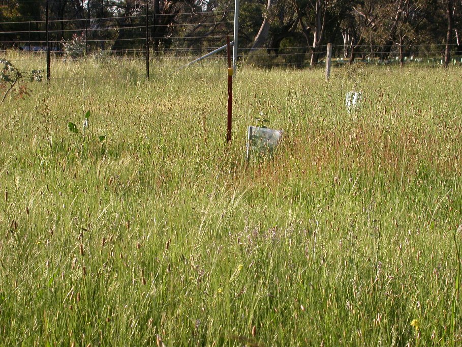
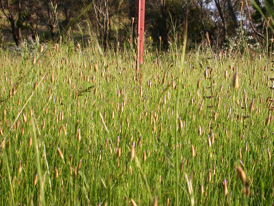
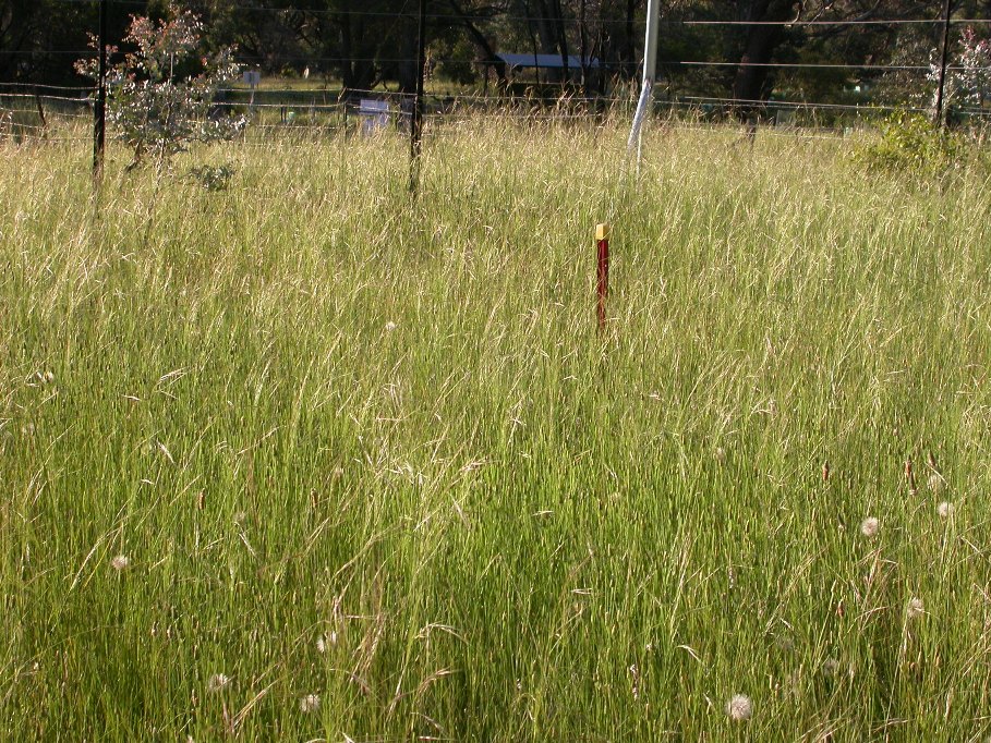
The significantly higher rainfall during the 2010 growing season compared to the corresponding long term average resulted in abundant growth of ground-cover, both inside and outside the fenced plots as shown in the set of the October 2010 photographs. However a closer inspection of the ground-cover revealed a remarkable difference: introduced species such as Proliferous Pink and Ribwort Plantain were most abundant on the grazed plot (View grazed plot and Close-up), whereas native Speargrass was dominant on the ungrazed plot (View ungrazed plot and Close-up).

The photograph of 18 November 2010 shows abundant introduced species in the grazed plot (front) and native grasses dominating the ungrazed plot (back).
Results of the point-step monitoring conducted one year (November 2010) and three years (November 2012) after construction of the animal sieve are shown below. For further results and more details, including a list of species, click on Results Monitoring Groundcover.
Native and introduced ground cover abundance. Abundance of introduced annual (blue), introduced perennial (red) and native perennial (green) groundcover plants one year (top) and three years (bottom) after fence construction in the rabbit and kangaroo grazed (left), rabbit only grazed (middle) and un-grazed (right) plots.

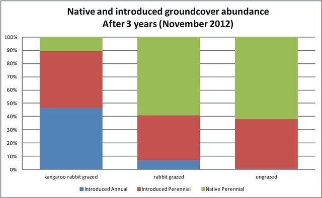
The results indicate that (1) grazing pressure reduce native ground-cover (control plot grazed by kangaroos and rabbits compared to fenced plots), and (2) the impact on native ground cover by kangaroo grazing exceeds the impact by rabbits (small difference between the two fenced plots).
Outlook
What are the impacts of the two grazers on the grassland diversity and abundance of native herbaceous species? To rigorously answer this question requires the regular monitoring of the presence and population size of native and introduced species in such a way as to remove the influence of soil type or other factors. The small and simple nature of our demonstration project means we could not rigorously answer this question. Instead, we hoped that our regular photographic monitoring would be sufficient to unambiguously identify species in the photographs. This was possible only on the first set of photos. Thereafter, the herbage biomass (abundance) became so large that unambiguous species identification is not possible. Nonetheless, on any day, an interested observer can walk around the boundary fences and compare the species presence and abundance, inside versus outside the plots. A scientifically rigorous answer to this question requires a scientifically designed experiment. Perhaps this is the next stage of this inquiry?
Project Information
Location: Mount Majura nature reserve behind the water reservoir off Rivett and French Streets, Hackett
Start: End of October 2009 (fence construction)
Sponsors: With assistance of an ACT Government Environment Grant (Department of Environment, Climate Change, Energy and Water); Molonglo Catchment Group Inc.; North Canberra Community Council (NCCC); Hackett Community Association (HCA)
Management: Friends of Mt Majura ParkCare Group
Contact: admin@majura.org
Project Documents
Grant Application (pdf)
Interpretative display (pdf)
Article Hackett Newsletter October 2009 edition (pdf)
Results of Monitoring Groundcover Abundance (xls)
FoMM Media Release 18.03.2013. The grazing impact of Kangaroos: A three year experiment.
Copies of the original high resolution photography are available on CD by contacting fomm.committee@gmail.com
Photographs used on this page by Waltraud Pix.
Visit the Friends of Mt Majura photographic essays:
Impact of overgrazing on the ecological condition of grassy woodland
Impact of overgrazing on work to improve degraded woodland at Mt Majura ridge

